
 A SCHOLARLY BOOK REPOSITORY
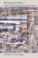
The austere landscape of the Great Basin has inspired diverse responses from the people who have moved through or settled in it. Author Richard V. Francaviglia is interested in the connection between environment and spirituality in the Great Basin, for here, he says, "faith and landscape conspire to resurrect old myths and create new ones." As a geographer, Francaviglia knows that place means more than physical space. Human perceptions and interpretations are what give place its meaning. In Believing in Place, he examines the varying human perceptions of and relationships with the Great Basin landscape, from the region's Native American groups to contemporary tourists and politicians, to determine the spiritual issues that have shaped our connections with this place. In doing so, he considers the creation and flood myths of several cultures, the impact of the Judeo-Christian tradition and individualism, Native American animism and shamanist traditions, the Mormon landscape, the spiritual dimensions of gambling, the religious foundations of Cold War ideology, stories of UFOs and alien presence, and the convergence of science and spirituality.
Believing in Place is a profound and totally engaging reflection on the ways that human needs and spiritual traditions can shape our perceptions of the land. That the Great Basin has inspired such a complex variety of responses is partly due to its enigmatic vastness and isolation, partly to the remarkable range of peoples who have found themselves in the region. Using not only the materials of traditional geography but folklore, anthropology, Native American and Euro-American religion, contemporary politics, and New Age philosophies, Francaviglia has produced a fascinating and timely investigation of the role of human conceptions of place in that space we call the Great Basin.
Winner, Friends of the Dallas Public Library Award, Texas Institute of Letters, 2001
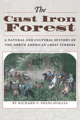
A complex mosaic of post oak and blackjack oak forests interspersed with prairies, the Cross Timbers covers a north-south belt of southern Kansas, eastern Oklahoma, and North Central Texas. Home to Native Americans over several thousand years, the Cross Timbers became a barrier to westward expansion in the nineteenth century, until roads and railroads opened it up to farmers and ranchers, coal miners, and modern city developers, all of whom changed its character in far-reaching ways.
This landmark book fully describes the natural environment of the Cross Timbers and the role that people have played in transforming the region. Richard Francaviglia opens with a natural history that discusses the region's geography and geology, vegetation, and climate. He then traces the interaction of people and the landscape, from the earliest Native American inhabitants and European explorers to the developers and residents of today's ever-expanding cities and suburbs. Many historical and contemporary maps and photographs illustrate the text.
Second Place, Presidio La Bahia Award, Sons of the Republic of Texas
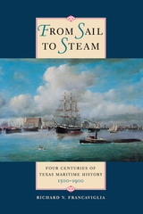
The Gulf Coast has been a principal place of entry into Texas ever since Alonso Alvarez de Pineda explored these shores in 1519. Yet, nearly five hundred years later, the maritime history of Texas remains largely untold. In this book, Richard V. Francaviglia offers a comprehensive overview of Texas' merchant and military marine history, drawn from his own extensive collection of maritime history materials, as well as from research in libraries and museums around the country.
Based on recent discoveries in nautical archaeology, Francaviglia tells the stories of the Spanish flotilla that wrecked off Padre Island in 1554 and of La Salle's flagship Belle, which sank in 1687. He explores the role of the Texas Navy in the Texas Revolution of 1835-1836 and during the years of the Texas Republic and also describes the Civil War battles at Galveston and Sabine Pass. Finally, he recounts major developments of the nineteenth century, concluding with the disastrous Galveston Hurricane in 1900. More than one hundred illustrations, many never before published, complement the text.
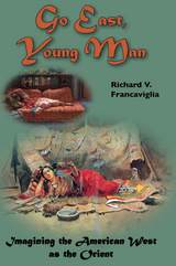
Transference of orientalist images and identities to the American landscape and its inhabitants, especially in the West—in other words, portrayal of the West as the “Orient”—has been a common aspect of American cultural history. Place names, such as the Jordan River or Pyramid Lake, offer notable examples, but the imagery and its varied meanings are more widespread and significant. Understanding that range and significance, especially to the western part of the continent, means coming to terms with the complicated, nuanced ideas of the Orient and of the North American continent that European Americans brought to the West. Such complexity is what historical geographer Richard Francaviglia unravels in this book.
Since the publication of Edward Said’s book, Orientalism, the term has come to signify something one-dimensionally negative. In essence, the orientalist vision was an ethnocentric characterization of the peoples of Asia (and Africa and the “Near East”) as exotic, primitive “others” subject to conquest by the nations of Europe. That now well-established point, which expresses a postcolonial perspective, is critical, but Francaviglia suggest that it overlooks much variation and complexity in the views of historical actors and writers, many of whom thought of western places in terms of an idealized and romanticized Orient. It likewise neglects positive images and interpretations to focus on those of a decadent and ostensibly inferior East.
We cannot understand well or fully what the pervasive orientalism found in western cultural history meant, says Francaviglia, if we focus only on its role as an intellectual engine for European imperialism. It did play that role as well in the American West. One only need think about characterizations of American Indians as Bedouins of the Plains destined for displacement by a settled frontier. Other roles for orientalism, though, from romantic to commercial ones, were also widely in play. In Go East, Young Man, Francaviglia explores a broad range of orientalist images deployed in the context of European settlement of the American West, and he unfolds their multiple significances.
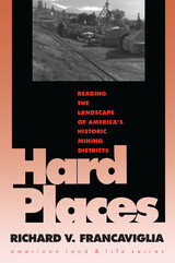
Working with the premise that there are much meaning and value in the "repelling beauty" of mining landscapes, Richard Francaviglia identifies the visual clues that indicate an area has been mined and tells us how to read them, showing the interconnections among all of America's major mining districts. With a style as bold as the landscape he reads and with photographs to match, he interprets the major forces that have shaped the architecture, design, and topography of mining areas. Covering many different types of mining and mining locations, he concludes that mining landscapes have come to symbolize the turmoil between what our society elects to view as two opposing forces: culture and nature.
The extremely varied geography of Texas, ranging from lush piney woods to arid, mountainous deserts, has played a major role in the settlement and development of the state. To gain full perspective on the influence of the land on the people of Texas, you really have to take to the air—and the authors of Historic Texas from the Air have done just that. In this beautiful book, dramatic aerial photography provides a complete panorama of seventy-three historic sites from around the state, showing them in extensive geographic context and revealing details unavailable to a ground-based observer.
Each site in Historic Texas from the Air appears in a full-page color photograph, accompanied by a concise description of the site's history and importance. Contemporary and historical photographs, vintage postcard images, and maps offer further visual information about the sites. The book opens with images of significant natural landforms, such as the Chisos Mountains and the Big Thicket, then shows the development of Texas history through Indian spiritual sites (including Caddo Mounds and Enchanted Rock), relics from the French and Spanish occupation (such as the wreck of the Belle and the Alamo), Anglo forts and methods of communication (including Fort Davis and Salado's Stagecoach Inn), nineteenth-century settlements and industries (such as Granbury's courthouse square and Kreische Brewery in La Grange), and significant twentieth-century locales, (including Spindletop, the LBJ Ranch, and the Dallas–Fort Worth International Airport).
For anyone seeking a visual, vital overview of Texas history, Historic Texas from the Air is the perfect place to begin.
Beginning with the indigenous Atacameño peoples at the southern edge of the Incan empire, the volume moves through five hundred years of history, sharing accounts written by Spanish, French, German, Dutch, British, American, and other travelers—pirates, scientists, explorers, and entrepreneurs among them. The Atacama’s austere landscape hides many secrets, including vast mineral wealth, the world's oldest mummies, and the more recent remains of dissidents murdered by the regime of former Chilean dictator Augusto Pinochet in the early 1970s. Today numerous observatories operate under the Atacama’s clear night skies, astronauts train on the rugged desert floor, and tourists flock there for inspiration.
In addition to a rich set of narratives, the book features 115 images—historical maps, photographs, and natural history illustrations, most in full color—to tell a more complete and compelling story. Imagining the Atacama Desert shows how what was once a wilderness at the edges of empire became one of South America's most iconic regions, one that continues to lure those seeking adventure and the unknown.
The series, established by one of the twentieth-century West's most distinguished historians, Leonard Arrington, has become a leading forum for prominent historians to address topics related to Mormon history. The first lecturer was Arrington himself. He was followed by Richard Lyman Bushman, Richard E. Bennett, Howard R. Lamar, Claudia L. Bushman, Kenneth W. Godfrey, Jan Shipps, Donald Worster, Laurel Thatcher Ulrich, and F. Ross Peterson. Utah State University hosts the Leonard J. Arrington Mormon History Lecture Series. The University Libraries' Special Collections and Archives houses the Arrington collection. The state's land grant university began collecting records very early, and in the 1960s became a major depository for Utah and Mormon records. Leonard and his wife Grace joined the USU faculty and family in 1946, and the Arringtons and their colleagues worked to collect original diaries, journals, letters, and photographs.
Although trained as an economist at the University of North Carolina, Arrington became a Mormon historian of international repute. Working with numerous colleagues, the Twin Falls, Idaho, native produced the classic Great Basin Kingdom: An Economic History of the Latter-day Saints in 1958. Utilizing available collections at USU, Arrington embarked on a prolific publishing and editing career. He and his close ally, Dr. S. George Ellsworth helped organize the Western History Association, and they created the Western Historical Quarterly as the scholarly voice of the WHA. While serving with Ellsworth as editor of the new journal, Arr ington also helped both the Mormon History Association and the independent journal Dialogue get established.
As an archetype for an entire class of places, Main Street has become one of America's most popular and idealized images. In Main Street Revisited, the first book to place the design of small downtowns in spatial and chronological context, Richard Francaviglia finds the sources of romanticized images of this archetype, including Walt Disney's Main Street USA, in towns as diverse as Marceline, Missouri, and Fort Collins, Colorado.
Francaviglia interprets Main Street both as a real place and as an expression of collective assumptions, designs, and myths; his Main Streets are treasure troves of historic patterns. Using many historical and contemporary photographs and maps for his extensive fieldwork and research, he reveals a rich regional pattern of small-town development that serves as the basis for American community design. He underscores the significance of time in the development of Main Street's distinctive personality, focuses on the importance of space in the creation of place, and concentrates on popular images that have enshrined Main Street in the collective American consciousness.
From their earliest days on the American frontier through their growth into a worldwide church, the spatially expansive Mormons made maps to help them create idealized communities, migrate to and colonize large parts of the American West, visualize the stories in their sacred texts, and spread their message internationally through a well-organized missionary system. This book identifies many Mormon mapmakers who played an important but heretofore unsung role in charting the course of Latter-day Saint history. For Mormons, maps had and continue to have both practical and spiritual significance. In addition to using maps to help build their new Zion and to explore the Intermountain West, Latter-day Saint mapmakers used them to depict locations and events described in the Book of Mormon.
Featuring over one hundred historical maps reproduced in full color—many never before published—The Mapmakers of New Zion sheds new light on Mormonism and takes readers on a fascinating journey through maps as both historical documents and touchstones of faith.
Winner of the Southwest Book Design and Production Award from the New Mexico Book Association.
Selected as one of the American Library Association's Best of the Best from University Presses.
The Great Basin was the last region of continental North America to be explored and mapped, and it remained largely a mystery to Euro-Americans until well into the nineteenth century. In Mapping and Imagination in the Great Basin, geographer-historian Richard Francaviglia shows how the Great Basin gradually emerged from its “cartographic silence” as terra incognita and how this fascinating process both paralleled the development of the sciences of surveying, geology, hydrology, and cartography and reflected the changing geopolitical aspirations of the European colonial powers and the United States. Francaviglia’s interdisciplinary account of the mapping of the Great Basin combines a chronicle of the exploration of the region with a history of the art and science of cartography and of the political, economic, and cultural contexts in which maps are created. It also offers a compelling, wide-ranging discussion that combines a description of the daunting physical realities of the Great Basin with a cogent examination of the ways humans, from early Native Americans to nineteenth-century surveyors to twentieth-century highway and air travelers, have understood, defined, and organized this space, psychologically and through the medium of maps. Mapping and Imagination in the Great Basin continues Francaviglia’s insightful, richly nuanced meditation on the Great Basin landscape that began in Believing in Place.
Francaviglia looks anew at the geographical-historical context of the driving of the golden spike in May 1869. He gazes outward from the site of the transcontinental railroad's completion—the summit of a remote mountain range that extends south into the Great Salt Lake. The transportation corridor that for the first time linked America's coasts gave this distinctive region significance, but it anchored two centuries of human activity linked to the area's landscape.
Francaviglia brings to that larger story a geographer's perspective on place and society, a railroad enthusiast's knowledge of trains, a cartographic historian's understanding of the knowledge and experience embedded in maps, and a desert lover's appreciation of the striking basin-and-range landscape that borders the Great Salt Lake.
READERS
Browse our collection.
PUBLISHERS
See BiblioVault's publisher services.
STUDENT SERVICES
Files for college accessibility offices.
RECENTLY PUBLISHED


UChicago Accessibility Resources
home | accessibility | search | about | contact us
BiblioVault ® 2001 - 2024
The University of Chicago Press